| |
 |
![]() Home > 항만정보 > 항만교통정보센터 Home > 항만정보 > 항만교통정보센터 |
|
 |
| |
|
| |
|
|
|
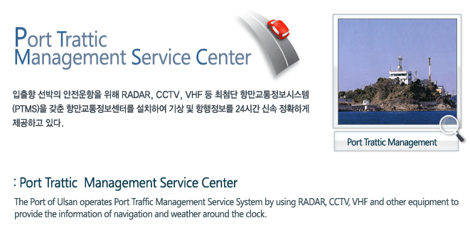
| ㆍPort Traffic Management Service Center |
: Channel 14,16 (Ulsan Port Service) |
| ㆍPilot |
: Channel 13 (Ulsan Pilot) |
| ㆍLocal Agent |
: Channel 16 (via Ulsan Radio) |
|
|
|
| |
|
|
|
| ㆍ 2 hour notice : ETA ?should be reported for berthing and/or anchoring information |
| ㆍ 2 mile notice : Approaching course and speed should be reported to identify each vessel |
| ※ Vessels needing pilotage must contact Ulsan Pilot as well as Ulsan Port Service |
| ㆍ Shifting report : Each vessel should do shifting report before and after her action |
| ㆍ Departure report : Notice should be given for the identification and the navigational information |
|
|
| !! Any contravention against above necessary reports will be fined 1,000,000₩ (Korean Won)!! |
|
|
|
| |
|
|
|
ㆍ to keep listening on Ch.14 always within and near Ulsan harbour
![]() (even he's passing-by
Ulsan harbour through the designated area)
(even he's passing-by
Ulsan harbour through the designated area) |
| ㆍ to confirm vessel's anchor position often and, if needed, to make any safety action
immediately |
| ㆍ and to keep clear Ulsan harbour at least 10 miles off while he is drifting near by Ulsan |
|
|
|
| |
|
|
|
 |
 |
 |
| Port Traffic Management Service Center |
Radar, CCTV, VHF and VHF-DSC |
ㆍDetection and identification on vessel's ![]() around Ulsan harbour around Ulsan harbour |
| Hwa-Am Chu light house |
Radar, VHF Direction Finder,
VHF and meteorological analyzer |
ㆍWeather check |
| ㆍInformation on traffic and weather |
| Bong-Dae Mountain |
Micro-Wave Relay |
ㆍDate transmission between service
![]() center and light house. center and light house. |
|
|
|
| |
|
|
|
 |
|
 |
| Pilot Station |
Lat. 35˚24´ 16˝ N
Long.129˚25´ 15˝ E |
Pilot boarding point but is subject to change case by case |
| Racon on Ulsan E.breakwater |
Lat. 35 ˚27´ 48˝ N
Long.129˚24´ 08˝ E |
with morse of "O" |
| Racon on SK C buoy(mooring buoy) |
Lat. 35˚25´ 42˝ N
Long.129˚23´ 27˝ E |
with morse of "C" |
| Hwa-Am-Chu L ight House |
Lat. 35˚28´ 10˝ N
Long.129˚24´ 37˝ E |
Generally, the anchor position in E-1,2 and 3 anchorage is measured by bearing and istance from this light house |
|
|
|
| |